
93215: Delano’s Geographic Delivery ZIP
The primary Delano ZIP code in the verified USPS scheme is 93215. It covers Delano street delivery and surrounding postal territory under the Delano, California routing label. The postal area is useful for standardizing an address, but it is not a legal map of Delano’s incorporated limits or a list of residents.
| ZIP code | Area description | Post office or routing label | Research note |
|---|---|---|---|
| 93215 | Delano street delivery and surrounding postal territory | Delano Post Office; DELANO CA 93215 routing | Primary geographic delivery ZIP |
| 93216 | Associated with Delano in the USPS scheme | Routes with Delano 93215 | Exact delivery classification was not stated in the inspected source |
The USPS ZIP lookup by address is the best way to verify a particular standardized address. A ZIP code directory search should preserve the full address and the lookup date rather than infer a neighborhood from the postal label.
Note: Postal territory can include land outside Delano’s incorporated line, so a ZIP match needs a city and county check.
Delano ZIP Delivery Classification
USPS associates 93216 with Delano and routes it with the 93215 Delano label. The inspected scheme does not state the exact delivery classification. No verified source supports calling 93216 PO-box-only, a separate residential neighborhood, or a unique institutional ZIP. Verify the full address before assigning a person, parcel, or jurisdiction to it.
The routing screenshot is linked to the official USPS scheme. It shows the postal relationship between the two codes, while the address lookup remains the right tool for a particular delivery point.
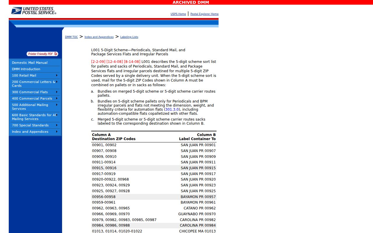
Keeping this uncertainty visible prevents a ZIP code directory from turning an incomplete postal classification into a local geography claim.
Delano ZIP and GIS Jurisdiction
USPS answers where mail is routed. Kern GIS answers how a parcel sits against Delano’s incorporated boundary, roads, easements, and neighboring county geography. The Kern assessor search can then connect a standardized address to an APN or ATN. These tools work in sequence because none is a complete resident directory.
The USPS lookup image below is linked to the official address form. Enter a full address, preserve the returned ZIP, and then compare it with the parcel and city boundary before choosing a county custodian.
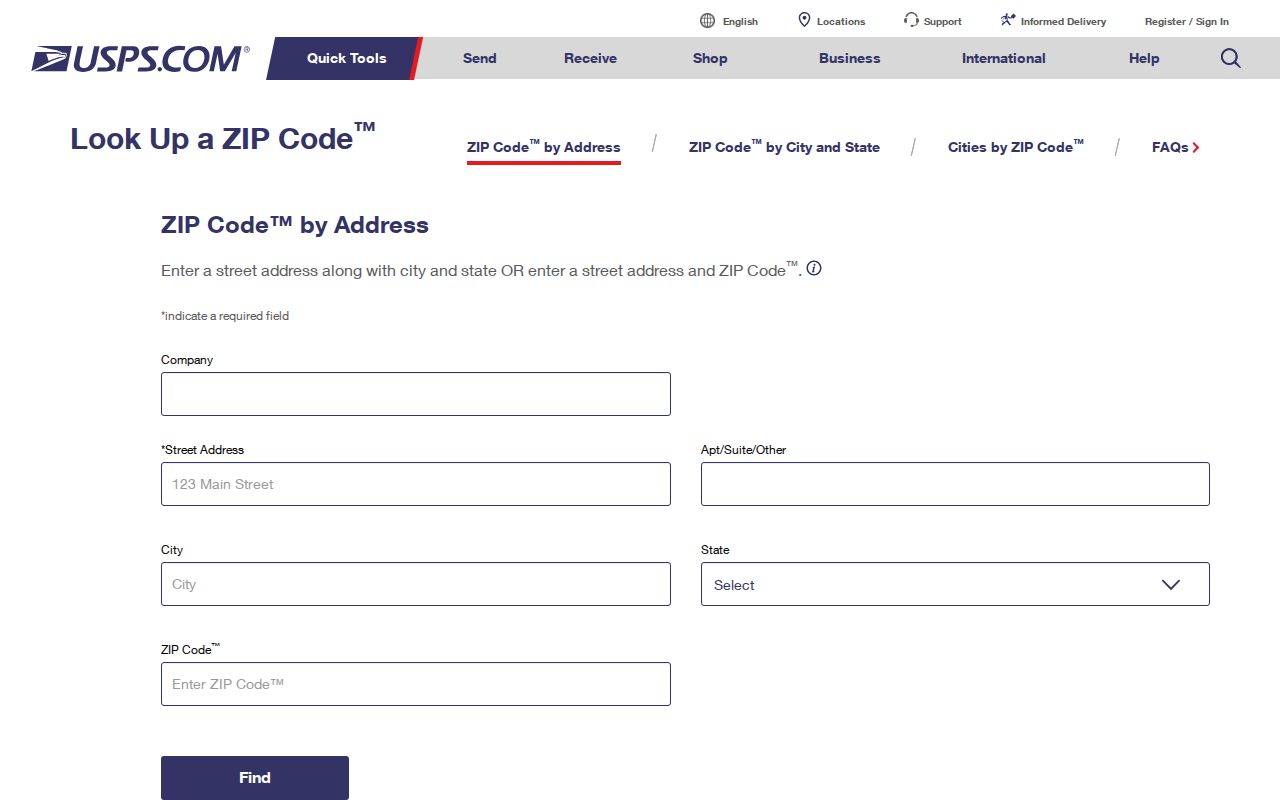
A delivery label can point to Kern County while a nearby event, parcel, or postal description needs a closer county check. Write down the complete address, APN, and record type before requesting a copy.
Finding Residents Within a Delano ZIP Code
A ZIP code can narrow the geographic question, but the research did not verify a ZIP-wide filter in the CAPTCHA-gated Kern assessor search or California voter self-lookup. Use the postal tool for an address, the parcel viewer for jurisdiction, and a lawful records channel for any named data. The postal directory workflow is therefore address-first, not a promise of one ZIP-wide resident result.
- Run the complete address through the USPS address lookup and save the standardized city, state, and ZIP response.
- Enter the address in Kern Property Search to obtain an APN or ATN. The public search accepts address, APN, or ATN as alternatives and suppresses owner names.
- Open the parcel in Kern GIS and compare the parcel with Delano’s incorporated boundary and surrounding county geography.
- Use a deed, court, business, license, or historical directory source according to the person or record question. Do not treat the ZIP as the person’s identity anchor.
- Hand the narrowed address to the Delano street directory workflow when street-level parcel research is the next step.
For approved voter data, the Kern application describes geography by county, district, precinct, or street rather than promising a public ZIP filter. For statistical questions, use Census ZCTA data as an approximation and label it as such.
Delano ZIP County Check
Delano lies near the northern edge of Kern County, close to Tulare County. That geography matters because the postal city can be broader than the incorporated city and a nearby event can belong to another county. A postal directory result should never decide where to order a deed, vital record, court file, or election record without checking the event or parcel jurisdiction.
When the question concerns a property, use the APN, GIS boundary, legal description, and recorder jurisdiction. When it concerns a birth, death, or marriage, verify where the event occurred. When it concerns a court case, use the court location and case type. The postal label is an initial clue only.
Delano ZIP Address Terms
ZIP research gets clearer when three address terms stay separate. Situs is the physical parcel address. Mailing is where tax correspondence goes. A legal description identifies the land through a lot, block, subdivision, or metes-and-bounds description. An APN is Kern’s tax and mapping key. A legal description usually survives postal spelling changes better than a street string, while an APN can change after a split or merger.
- Situs
- Where the parcel physically sits. It is the point to test against GIS and city limits.
- Mailing
- Where the owner’s tax correspondence is sent. It may be outside Delano and does not prove occupancy.
- APN
- The assessor’s parcel identifier used to connect property search and map context.
- Legal description
- The recorded land identity that ties a deed to a parcel when a postal address changes.
Kern map books exceed 450, with fewer than 100 pages in a book, and hardcopy assessment maps remain official. A ZIP code directory entry should preserve the address form and APN together rather than treating the postal code as the parcel key.
Delano ZIP Statistical Areas
Census ZCTAs are statistical areas designed to approximate ZIP geography. They are useful for population and demographic context, but they are not a precise USPS delivery roster and should not be presented as exact ZIP population. Delano’s 2020 Census population was 51,428, with 12,647 total units and 12,071 households in the cited profile. Those figures describe a city profile, not the people attached to a ZIP code directory search.
The Census QuickFacts route can add context for a research question, while USPS remains the delivery authority and Kern GIS remains the parcel and boundary tool. Keep statistical geography, postal geography, and municipal geography labeled in separate columns or notes.
Delano’s 14.72 square miles and northern-edge position make the distinction especially important. A postal territory can contain addresses outside the city line, and a city description can omit the county or parcel detail needed for a records request.
Delano ZIP Assessor Limits
The supplied research did not verify a ZIP-wide filter in the CAPTCHA-gated Kern Property Search or in California’s private voter status tool. Do not promise a countywide ZIP result that the official interfaces do not document. A specific address can be standardized with USPS, mapped in GIS, and used to obtain an APN. A named person still requires a different record trail.
For a defensible ZIP note, preserve four separate values: the address exactly as supplied, the USPS standardized response, the parcel key returned by Kern, and the jurisdiction shown by GIS. If one of those values conflicts, stop at the conflict rather than resolving it by the postal city label. A 93215 result may be useful for delivery, while the recorder, court, or elections office still depends on the event or parcel location.
The same method applies to a list of addresses. Standardize each address individually, retain failed lookups, and record whether a result is a street delivery, box route, or another postal classification. The research did not verify a citywide assessor export filtered by ZIP, so a hand-built address set is more transparent than a claimed directory-wide count.
Keep the lookup date beside each postal result. A routing table can show an association without explaining a municipal boundary, and that missing classification is itself a finding worth reporting.
For approved voter data, Kern’s application describes countywide, district, precinct, and street or walking-file choices, with delivery and fee options. It does not establish an unrestricted ZIP search. For a city record, the Delano public-records request form can be targeted by address, APN, department, and date range. For county records, use the Kern property and land hub as a navigation point.
Delano ZIP Boundaries and City
USPS routing and municipal jurisdiction describe different geographies. The inspected scheme pairs 93215 and 93216 with Delano, but the postal boundary can extend beyond the incorporated city. Delano sits at Kern County’s northern edge near Tulare County, so a postal city name is not enough to choose a recorder, court, elections, or vital-record custodian.
- ZIP versus ZIP+4
- A ZIP code identifies a delivery area. The four extra digits narrow a delivery point or route within it.
- PO-box ZIP
- A postal code used for box delivery. The research did not verify that 93216 is PO-box-only.
- Unique ZIP
- A code assigned to one organization or delivery point. No Delano unique-ZIP finding was verified here.
- Carrier route
- A delivery path used by the postal system. It is not a neighborhood or legal parcel boundary.
- ZCTA
- A Census statistical approximation that resembles a ZIP area. It should not be labeled as exact USPS population.
Jurisdiction check. Verify the parcel in GIS and confirm the event county before ordering a deed, vital record, or court file from a Delano-labeled address.